Mill Creek
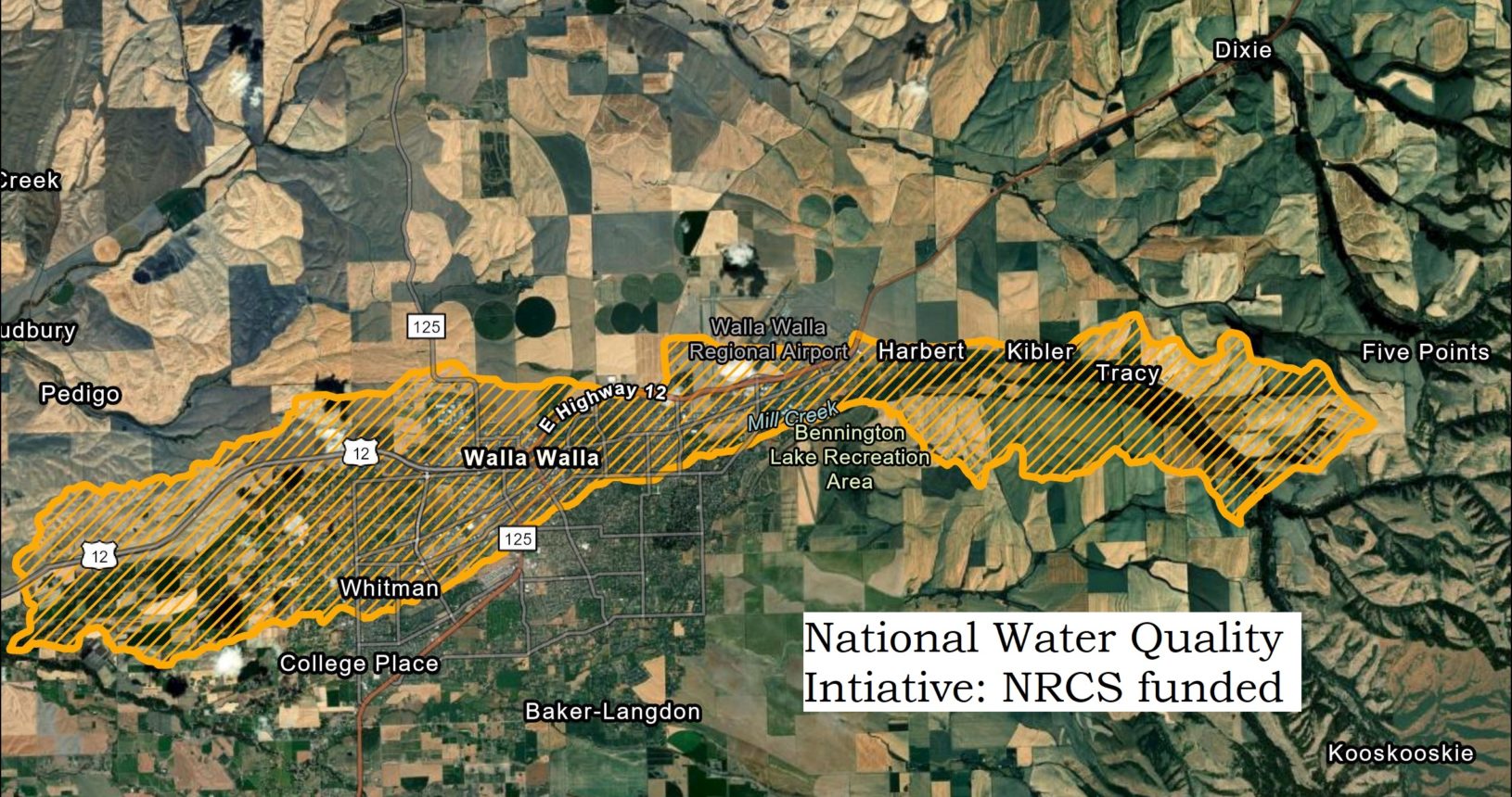
The National Water Quality Intiative helps identify potential project sites for NRCS funded restoration.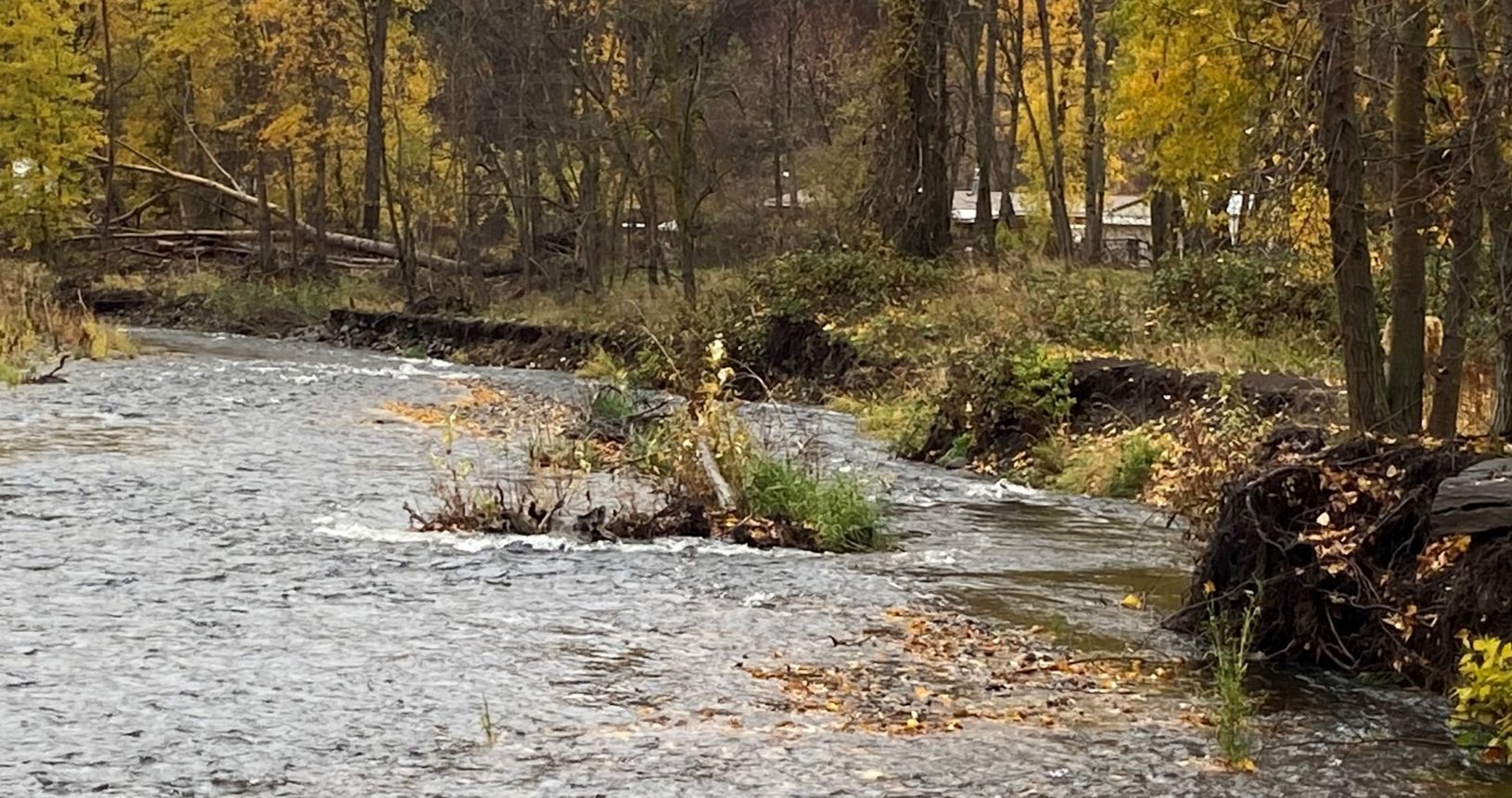
Mill Creek
Mill Creek
This image shows bank erosion during a high flow event.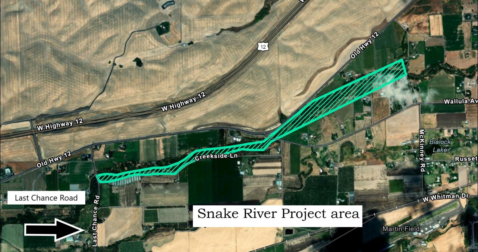
Mill Creek
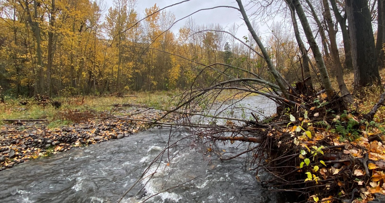
This project will help landowners install projects to improve fish habitat, address flooding, and decrease sediment in the river.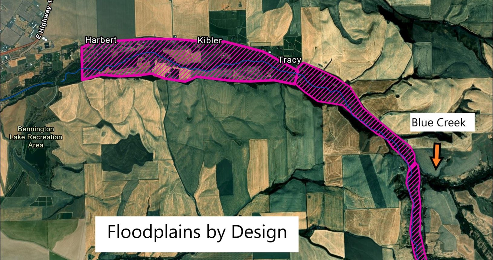
Mill Creek
Floodplains by Design funds will help landowners develop projects to restore floodplain function and reduce the damage to property.
This fall marks the start of the district’s multi-phased projects prioritizing the Mill Creek watershed. These projects will span several years. At WWCCD we are committed to addressing local concerns and improving stream conditions. Over the next two years, WWCCD staff will be in the Mill Creek region conducting surveys and working with landowners to help prevent property damage from floods, enhance habitat, and improve water quality. This video of the March 2020 Flood was provided by a landowner.
The district has obtained three grants to fund the work.
The Floodplains by Design project focuses on improving floodplain connectivity. The goal is to help with flood recovery and improve the region’s ability to handle future high-water events by restoring and improving the floodplain. By restoring natural floodplain function, flood water can be directed away from infrastructure (homes, roads, buildings) and instead to historical flood areas where flood energy can be safely dispersed and waters slowed. The first phase of this project is between Wickersham bridge and Blue Creek. WWCCD staff will engage with landowners to gain their input on what’s needed to protect their land and the surrounding ecosystems. This work is funded by a grant from the Department of Ecology.
The district also obtained a Natural Resource Conservation Service (NRCS) National Water Quality Initiative (NWQI) program. The NWQI supports voluntary farm conservation projects that focus on water quality improvements in a particular reach or watershed. The district will conduct field surveys with landowners to identify current conditions and then find the NRCS-funded practices that could be implemented to improve water quality conditions. These include practices to promote soil health, reduce erosion and lessen nutrient runoff to benefit natural resources while enhancing agricultural productivity. The NWQI project area is from the mouth/confluence with the Walla Walla River up to the confluence with Blue Creek.
Finally, a Snake River Salmon Recovery project is also in progress to develop a stream restoration design with a specific emphasis on salmon habitat. It’s focusing on the 2-mile reach between the Last Chance Road Bridge up to the Wallula Avenue Bridge. Mill Creek is within a designated Major Spawning Area (MSA) for Mid-Columbia steelhead from its confluence with the Walla Walla River upstream to its head waters. It’s focusing on the 2-mile reach between the Last Chance Road Bridge up to the Wallula Avenue Bridge, and is funded by the state Recreation and Conservation Office.
Why are we doing this all this work in the Mill Creek area? According to the Water Distribution Division for the City of Walla Walla, the Mill Creek Watershed supplies 80-90% of the city’s water needs. These projects aim to uphold and enhance water quality for our residents and their water needs. Flood events have damaged private properties and people’s livelihood. These projects work to reduce future flood damage. Mill Creek provides ideal fish habitat and is essential for recovery of the Walla Walla River population of Mid-Columbia Steelhead.. We are looking forward to working on these Mill Creek projects with the local community and stakeholder groups. If you have any questions relating to these projects please contact Alison Crowley, Project manager, at the district office.